



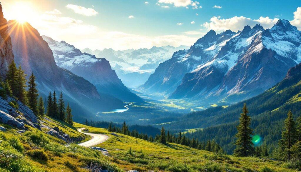
The Rocky Mountains stretch across North America like a natural cathedral, offering some of the continent’s most breathtaking vistas and unforgettable driving experiences. From glacier-carved valleys to high alpine passes, these routes showcase nature’s grandeur at every turn. Whether you’re seeking dramatic mountain peaks, crystalline lakes, or wildlife encounters, the scenic drives through the Rockies deliver experiences that linger long after the journey ends. These seven remarkable routes combine accessibility with awe-inspiring beauty, making them essential additions to any traveller’s itinerary.
The Majesty of the Glacier Route
A Journey Through Time and Ice
The Glacier Route winds through Glacier National Park in Montana, presenting drivers with a spectacular display of geological wonders. This historic highway, known as the Going-to-the-Sun Road, spans approximately 50 miles and crosses the Continental Divide at Logan Pass. The route typically opens in late spring, though snow can linger well into summer at higher elevations.
Travellers encounter numerous highlights along this remarkable drive:
- Lake McDonald’s pristine waters reflecting surrounding peaks
- Weeping Wall, where waterfalls cascade directly onto the roadway
- Logan Pass Visitor Centre at 6,646 feet elevation
- Hidden Lake Overlook offering panoramic mountain views
- Abundant wildlife including mountain goats, bighorn sheep, and grizzly bears
Engineering Marvel Meets Natural Beauty
The road’s construction represents a remarkable engineering achievement, completed in 1932 after eleven years of challenging work. The narrow roadway hugs cliff faces and navigates hairpin turns, creating an intimate connection with the surrounding landscape. Stone guardrails and historic architecture blend seamlessly with the natural environment, preserving the area’s pristine character.
| Feature | Details |
|---|---|
| Total Length | 50 miles |
| Highest Point | 6,646 feet (Logan Pass) |
| Typical Opening | Late June to early July |
| Average Drive Time | 2-3 hours without stops |
As the Glacier Route demonstrates the power of ancient ice to shape landscapes, another iconic parkway continues this theme of glacial grandeur further north.
Exploring the Beauty of the Icefields Parkway
Canada’s Crown Jewel of Scenic Highways
The Icefields Parkway connects Jasper and Banff National Parks across 144 miles of unparalleled mountain scenery. This Alberta treasure showcases more than 100 ancient glaciers, turquoise lakes, and towering peaks that define the Canadian Rockies. The highway follows historic Indigenous routes and early exploration paths, creating a corridor through wilderness largely unchanged for centuries.
Key attractions along this magnificent route include:
- Athabasca Glacier, accessible via the Columbia Icefield
- Peyto Lake’s distinctive wolf-head shape and brilliant blue waters
- Bow Lake reflecting the Crowfoot Glacier
- Sunwapta Falls thundering through narrow canyons
- Saskatchewan River Crossing, a historic meeting point
Wildlife and Wilderness Encounters
The parkway traverses critical wildlife habitat, offering exceptional opportunities to observe animals in their natural environment. Black bears, grizzly bears, elk, caribou, and wolves frequent the corridor, particularly during dawn and dusk hours. Designated pullouts provide safe viewing locations whilst protecting both visitors and wildlife.
The route’s relatively gentle gradients make it accessible to most vehicles, though weather conditions can change rapidly at higher elevations. Summer months offer the most reliable access, whilst autumn brings golden larches and reduced traffic volumes.
Whilst the Icefields Parkway showcases glacial landscapes in their full glory, the American Southwest offers its own dramatic mountain driving experience.
The Hidden Wonders of the Million Dollar Highway
Colorado’s Most Thrilling Mountain Pass
The Million Dollar Highway forms part of the San Juan Skyway, connecting Ouray and Silverton through some of Colorado’s most dramatic terrain. This 25-mile section earns its name either from the cost of construction, the precious ore in the roadbed, or the priceless views—depending on which legend you prefer. The route climbs to 11,018 feet at Red Mountain Pass, offering vertiginous drops and spectacular vistas.
Mining Heritage and Mountain Grandeur
Historic mining operations left their mark along this route, with abandoned structures clinging to impossibly steep slopes. The road passes through:
- Ouray, the “Switzerland of America”
- Red Mountain Mining District with colourful mineral deposits
- Silverton, a preserved Victorian mining town
- Uncompahgre Gorge’s sheer canyon walls
| Characteristic | Specification |
|---|---|
| Length | 25 miles |
| Peak Elevation | 11,018 feet |
| Guardrails | Minimal to none in sections |
| Road Width | Narrow, two-lane |
The absence of guardrails on certain sections adds to the adventure, though modern road maintenance ensures safe passage for cautious drivers. Winter closures occasionally occur, making summer and autumn the preferred seasons for this thrilling drive.
From the mining heritage of the Million Dollar Highway, travellers can discover another Colorado route offering high-altitude thrills.
The Escape through Loveland Pass Road
Above the Treeline Adventure
Loveland Pass Road provides a spectacular alternative to the Eisenhower Tunnel, climbing to 11,990 feet and offering unobstructed views across the Continental Divide. This route remains popular with cyclists, motorcyclists, and drivers seeking a more intimate mountain experience than the interstate highway provides.
The pass delivers exceptional alpine scenery, with tundra vegetation, rocky peaks, and frequent wildlife sightings. The relatively short distance—approximately 5 miles from base to summit—concentrates dramatic elevation changes and sweeping vistas into a compact journey.
Year-Round Accessibility and Recreation
Unlike many high mountain passes, Loveland Pass typically remains open throughout winter, though conditions can be challenging. The area attracts backcountry skiers, snowboarders, and winter enthusiasts who appreciate the accessible high-altitude terrain. Summer visitors enjoy hiking trails radiating from the summit, including routes to nearby peaks and alpine lakes.
Whilst Loveland Pass offers high-altitude thrills, another Colorado route provides a different perspective on mountain beauty.
The Authenticity of the Cheyenne Mountain Road
Colorado Springs’ Hidden Gem
Cheyenne Mountain Road offers a lesser-known scenic experience near Colorado Springs, winding through diverse ecosystems from prairie grasslands to montane forests. The route provides access to the Cheyenne Mountain Zoo and the famous Broadmoor resort whilst showcasing the transition between plains and mountains.
This drive features:
- Panoramic views across Colorado Springs and the Front Range
- Access to numerous hiking trails and picnic areas
- Historic Cheyenne Mountain Zoo, America’s only mountain zoo
- Seven Falls, a series of cascading waterfalls in a box canyon
- North Cheyenne Cañon Park with its dramatic rock formations
Ecological Diversity in Compact Form
The relatively short distance encompasses remarkable biodiversity, with vegetation and wildlife changing noticeably as elevation increases. Ponderosa pines dominate lower slopes, giving way to Douglas fir and aspen at higher elevations. Wildlife includes mule deer, black bears, mountain lions, and numerous bird species.
After exploring Cheyenne Mountain’s ecological variety, visitors can experience Colorado’s highest paved road.
The Picturesque Charm of Trail Ridge Road
America’s Highest Continuous Paved Road
Trail Ridge Road crosses Rocky Mountain National Park, reaching 12,183 feet at its highest point and spending eleven miles above treeline. This 48-mile route connects Estes Park and Grand Lake, traversing ecosystems equivalent to travelling from Colorado to the Arctic Circle. The road typically opens in late May and closes with the first significant snowfall in October.
Alpine Tundra and Wildlife Abundance
The extended time above treeline provides unparalleled access to fragile alpine tundra ecosystems. Visitors observe:
- Elk herds grazing in mountain meadows
- Bighorn sheep navigating rocky slopes
- Marmots sunning on boulder fields
- Rare alpine wildflowers during brief summer blooming periods
- Dramatic weather systems developing across the Continental Divide
| Trail Ridge Road Facts | Information |
|---|---|
| Maximum Elevation | 12,183 feet |
| Total Length | 48 miles |
| Miles Above Treeline | 11 miles |
| Typical Season | Late May to mid-October |
Interpretive Opportunities and Visitor Centres
Multiple visitor centres and interpretive stops along the route provide context for the surrounding landscape. The Alpine Visitor Centre at Fall River Pass offers exhibits on tundra ecology, whilst numerous pullouts feature informational panels explaining geological formations, wildlife behaviour, and human history in the region.
These seven scenic drives through the Rockies offer diverse experiences united by extraordinary natural beauty. From the glacial majesty of Montana and Alberta to the high passes of Colorado, each route provides unique perspectives on mountain landscapes. The Glacier Route and Icefields Parkway showcase ancient ice and pristine wilderness, whilst the Million Dollar Highway and Loveland Pass deliver thrilling high-altitude adventures. Cheyenne Mountain Road demonstrates ecological diversity in compact form, and Trail Ridge Road grants access to fragile alpine environments rarely experienced by most travellers. Whether seeking dramatic vistas, wildlife encounters, or simply the pleasure of mountain driving, these routes deliver unforgettable journeys through North America’s most spectacular terrain.