


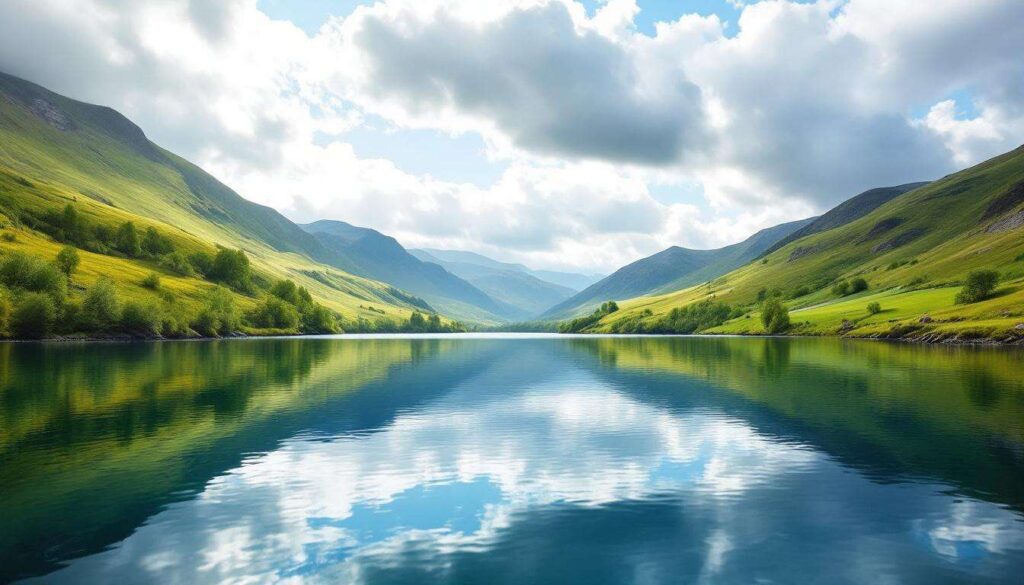
The United Kingdom harbours some of Europe’s most remarkable freshwater bodies, with Scottish lochs dominating the list of the deepest natural lakes. These geological marvels, carved by ancient glaciers during successive ice ages, plunge to astonishing depths that rival many continental European lakes. From the legendary waters of Loch Ness to the lesser-known but equally impressive Loch Morar, Britain’s deepest lakes represent not only natural wonders but also vital ecosystems supporting diverse wildlife and communities. Understanding these aquatic giants provides insight into the nation’s geological history and the environmental challenges facing these precious resources.
The deepest lakes in the United Kingdom
Top ten ranking by maximum depth
Scotland’s glacial legacy has created a concentration of exceptionally deep lakes, with all ten of the United Kingdom’s deepest lakes located north of the border. The ranking reveals the dramatic underwater topography that characterises the Scottish Highlands and demonstrates the powerful erosive forces that shaped this landscape over millennia.
| Rank | Lake Name | Maximum Depth | Location |
|---|---|---|---|
| 1 | Loch Morar | 310 metres | Lochaber, Highland |
| 2 | Loch Ness | 230 metres | Scottish Highlands |
| 3 | Loch Lomond | 190 metres | West Dunbartonshire |
| 4 | Loch Lochy | 162 metres | Great Glen, Highland |
| 5 | Loch Ericht | 156 metres | Perth and Kinross |
| 6 | Loch Tay | 150 metres | Perth and Kinross |
| 7 | Loch Shiel | 128 metres | Lochaber, Highland |
| 8 | Loch Katrine | 151 metres | Stirling |
| 9 | Loch Rannoch | 134 metres | Perth and Kinross |
| 10 | Loch Arkaig | 109 metres | Lochaber, Highland |
Geographical distribution patterns
The concentration of deep lakes in specific regions reflects geological fault lines and glacial pathways that determined where ice could carve most effectively into the bedrock. The Great Glen, which hosts both Loch Ness and Loch Lochy, represents a major geological fault line running diagonally across Scotland, creating ideal conditions for exceptionally deep water bodies.
This geographical clustering demonstrates how tectonic activity and subsequent glaciation worked in tandem to create Britain’s underwater canyons. The physical characteristics of these lakes continue to shape the understanding of Scotland’s geological past and present environmental conditions.
Analysis of the characteristics of British lakes
Glacial formation processes
Glacial erosion during the Pleistocene epoch carved out the deep basins that now hold Scotland’s most impressive lakes. As massive ice sheets advanced and retreated over hundreds of thousands of years, they scoured valleys and deepened pre-existing river courses, creating the distinctive U-shaped profiles characteristic of glacial lakes.
The process involved several mechanisms:
- Plucking of bedrock fragments from the valley floor
- Abrasion by rock debris embedded in glacial ice
- Meltwater erosion beneath ice sheets
- Post-glacial isostatic adjustment affecting water levels
Bathymetric features and underwater topography
The underwater landscapes of Britain’s deepest lakes reveal complex topographies with steep-sided trenches, underwater ridges and sediment-filled basins. Modern sonar mapping has uncovered previously unknown features, including submerged rock formations and ancient landslide deposits that tell stories of dramatic geological events.
These bathymetric surveys have revolutionised scientific understanding of lake formation and continue to yield discoveries about past climate conditions, sedimentation rates and ecosystem development over thousands of years.
Water quality and temperature stratification
Deep lakes exhibit distinct thermal layering, with warmer surface waters separated from cold bottom layers by a thermocline. This stratification affects oxygen distribution, nutrient cycling and the distribution of aquatic life throughout different depth zones.
The characteristics of these stratification patterns vary seasonally and influence everything from fish populations to chemical composition, making depth a crucial factor in understanding lake ecology and water quality management.
Loch Morar: the deepest
Record-breaking dimensions
Loch Morar holds the distinction of being not only the deepest lake in the United Kingdom but also the deepest freshwater body in the British Isles. Its maximum depth of 310 metres exceeds that of Loch Ness by 80 metres, yet it remains far less famous than its celebrated neighbour.
The loch stretches approximately 18.8 kilometres in length and contains an estimated volume of water exceeding 2.3 cubic kilometres, making it a substantial freshwater reservoir despite its relatively narrow width.
Unique ecological features
The extreme depth creates unusual ecological conditions that support distinctive communities of organisms adapted to life in the cold, dark bottom waters. The loch contains populations of Arctic char, a relic species from the last ice age, alongside brown trout and Atlantic salmon.
Scientists have documented unique benthic communities inhabiting the deepest zones, where light never penetrates and temperatures remain consistently cold throughout the year, creating conditions more typical of arctic environments.
Local legends and cultural significance
Like Loch Ness, Loch Morar has its own legendary creature, Morag, described in local folklore as a mysterious aquatic inhabitant. Whilst sightings lack the international fame of the Loch Ness Monster, local traditions maintain accounts of unexplained phenomena in these deep waters.
The loch’s cultural importance extends beyond folklore, serving as a vital resource for local communities and featuring in Gaelic poetry and traditional songs that celebrate the landscape’s natural beauty.
Loch Ness: mystery and depth
Dimensions and volume
Loch Ness, whilst ranking second in maximum depth at 230 metres, contains more water by volume than all the lakes in England and Wales combined. This extraordinary volume results from its considerable length of 36 kilometres and consistent depth throughout much of its extent.
The loch’s surface area covers approximately 56 square kilometres, and its total volume exceeds 7.4 cubic kilometres, making it the largest lake by volume in the British Isles despite not being the deepest or longest individually.
Scientific research and exploration
Extensive scientific investigations have employed sophisticated sonar equipment, submersible vehicles and remote sensing technology to map the loch’s floor and investigate its ecology. These studies have revealed complex underwater topography including steep drop-offs, sediment deposits metres thick and evidence of ancient landslides.
Research programmes continue to examine sedimentation rates, water chemistry and biological communities, contributing valuable data about post-glacial environmental change and contemporary ecosystem dynamics.
Tourism and economic impact
The loch generates substantial economic activity through tourism, with millions of visitors drawn by the combination of natural beauty and legendary mystery. This visitor economy supports local employment in hospitality, transport and interpretation services whilst raising awareness of Highland landscapes and conservation needs.
Little-known deep lakes of Scotland
Loch Lochy and the Great Glen
Positioned within the Great Glen between Loch Ness and Loch Linnhe, Loch Lochy reaches depths of 162 metres and forms part of the Caledonian Canal system. Its strategic location has made it important for navigation whilst its depth provides habitat for significant fish populations.
The loch’s integration into the canal system demonstrates how deep natural lakes have been adapted for human purposes whilst largely maintaining their ecological integrity.
Loch Ericht’s remote grandeur
Loch Ericht, reaching 156 metres in depth, occupies a remote location in the Central Highlands that limits visitor numbers but preserves its pristine character. The loch serves as a reservoir for hydroelectric power generation, demonstrating the multiple values these deep lakes provide.
Its elongated shape and consistent depth make it particularly valuable for water storage and power generation whilst supporting populations of brown trout and Arctic char in its cold, nutrient-poor waters.
Loch Tay’s historical importance
With a maximum depth of 150 metres, Loch Tay has played a significant role in Scottish history and culture. Ancient crannogs, artificial islands built for defensive purposes, dot the loch, providing archaeological evidence of human habitation dating back thousands of years.
The loch’s depth and water quality have made it valuable for both fishing and as a freshwater resource, whilst its scenic setting attracts tourists exploring Perthshire’s natural heritage.
Environmental impact of deep lakes in the United Kingdom
Climate regulation and carbon storage
Deep lakes function as significant carbon sinks, storing organic matter in sediments that accumulate on their floors over millennia. The cold, oxygen-poor conditions in the deepest zones slow decomposition, effectively locking carbon away from the atmosphere for extended periods.
These water bodies also moderate local climates by absorbing heat during summer and releasing it gradually during winter, creating microclimates that influence surrounding vegetation and weather patterns.
Biodiversity and habitat provision
The varied depth zones within these lakes create multiple distinct habitats supporting diverse communities of organisms. Surface waters host phytoplankton and fish species requiring light and warmth, whilst deeper zones provide refuge for cold-adapted species and invertebrate communities.
Key biodiversity values include:
- Relic populations of Arctic char from post-glacial periods
- Unique assemblages of benthic invertebrates adapted to deep, cold conditions
- Important spawning grounds for migratory fish species
- Habitat for rare aquatic plants in shallow marginal zones
Contemporary environmental pressures
Despite their depth and volume, these lakes face environmental challenges including nutrient enrichment, invasive species and climate change impacts. Warming temperatures affect stratification patterns, potentially disrupting established ecological relationships and threatening cold-adapted species.
Pollution from agricultural runoff, forestry operations and atmospheric deposition introduces nutrients and contaminants that can accumulate in sediments and affect water quality. Management strategies must address these pressures whilst balancing recreational use, water extraction and conservation priorities.
Conservation and management approaches
Effective stewardship of Britain’s deepest lakes requires integrated catchment management addressing both the lakes themselves and their surrounding watersheds. Protective designations, including Sites of Special Scientific Interest and Special Areas of Conservation, provide legal frameworks for conservation whilst allowing sustainable use.
Monitoring programmes track water quality, biological communities and physical conditions, providing data essential for adaptive management responses to emerging threats. Collaboration between governmental agencies, research institutions and local communities ensures that conservation efforts reflect both scientific evidence and local knowledge.
The United Kingdom’s deepest lakes represent irreplaceable natural assets combining geological significance, ecological value and cultural importance. From Loch Morar’s record-breaking depths to the internationally recognised waters of Loch Ness, these water bodies embody Scotland’s glacial heritage whilst supporting contemporary ecosystems and human communities. Their protection requires continued scientific research, effective regulatory frameworks and public engagement to ensure these remarkable landscapes endure for future generations. The challenges facing these lakes mirror broader environmental pressures affecting freshwater systems globally, making their conservation both a national priority and a contribution to international efforts to protect vital water resources.